Projets
Definspace 2025 — Surveillance vidéo temps réel LEO
Hackathon — vidéo temps réel LEO.
Participation au Hackathon DefInSpace : 24 heures pour concevoir une infrastructure sol/bord permettant la vidéo temps réel depuis la LEO. Objectif : proposer une architecture de bout en bout, de la capture optique embarquée à la réception sol, sous contraintes bande passante, latence et cybersécurité.
Plan d'action :
- Constellation de 6 satellites LEO (200–2000 km) pour capturer des vidéos en quasi temps réel d’objets spatiaux (adverses, d’intérêt, débris).
- Stations sol et antennes pour l’observation des passages, la corrélation de trajectoires et la planification des prises de vue.
- Appui sur GRAVES et HELIX (si disponibles) pour trajectoires/états au sol et un catalogage plus fiable.
- Fonctionnement inspiré des missions Sentinel (optique + chaîne image), prétraitement embarqué pour réduire le débit, downlink priorisé sur fenêtres optimisées.
- Résolution cible ≈ 10 cm/px à 180 km sur cibles prioritaires.
Pourquoi ces informations ? Identifier, comprendre les intentions et caractériser les capacités pour accélérer la boucle renseignement et éclairer la décision C2.
- Longueur d’antenne → bande/fréquence estimée.
- Surface des panneaux → puissance/consommation approximative.
- Radiateurs → possible charge utile infrarouge et besoins thermiques.
Livrables. Plan d’action, architectures sol/bord et pipeline temps réel vers un outil C2 unifié.
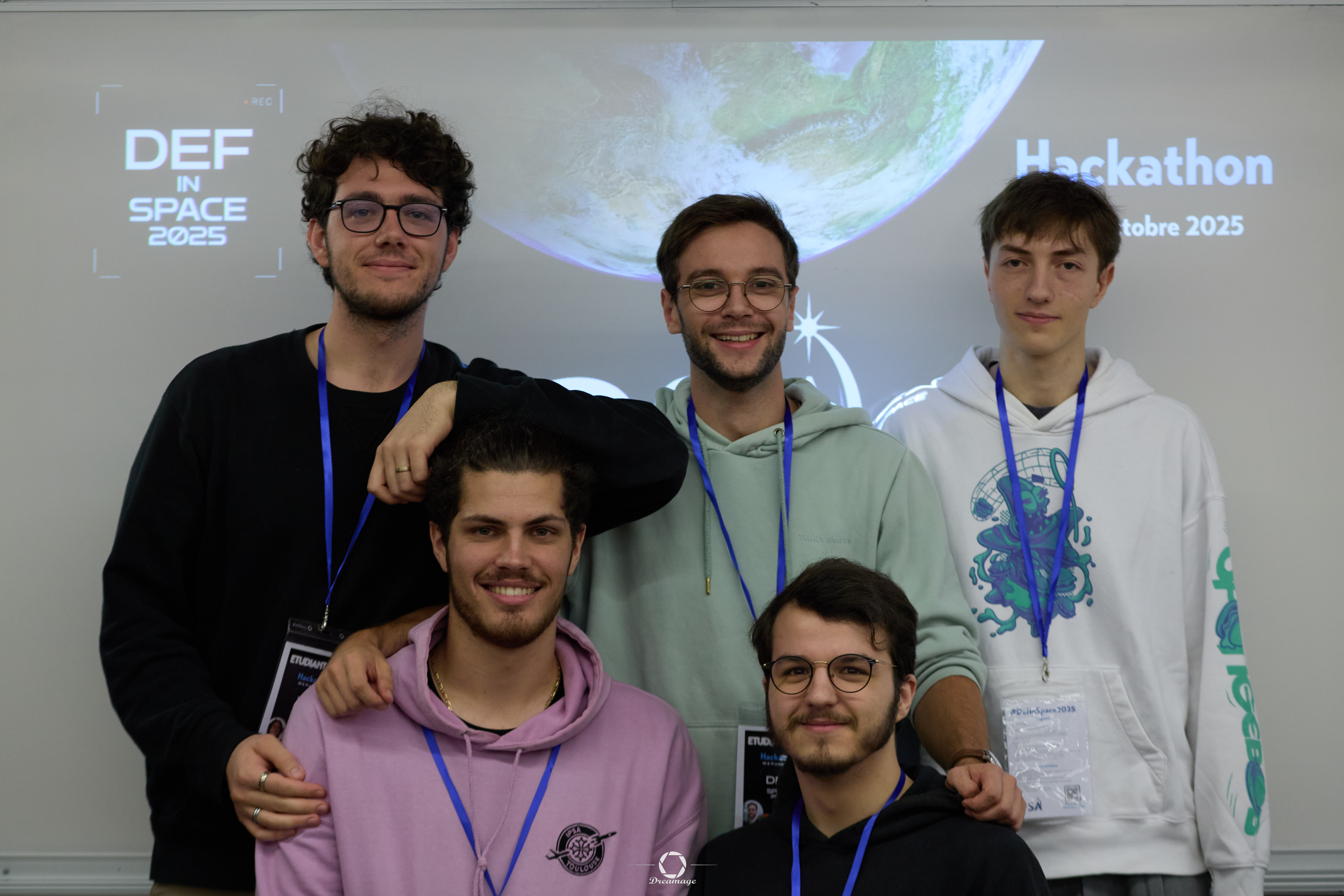
Date. Réalisé le 14 octobre 2025. Nous, l’équipe CapiTools, avons humblement remporté l’édition locale à l’IPSA. La suite le 28 novembre 2025 pour les demi‑finales…
Participation in the DefInSpace Hackathon: 24 hours to design a complete ground/space infrastructure enabling real-time video transmission from Low Earth Orbit (LEO). The objective was to deliver an end-to-end architecture, from onboard optical capture to ground reception, under strict bandwidth, latency, and cybersecurity constraints.
Action plan:
- 6‑satellite LEO (200–2000 km) constellation for near real‑time video of space objects (adversary, interest, debris).
- Ground stations for pass observation, trajectory correlation and imaging planning.
- Leverage GRAVES and HELIX (when available) for ground‑based orbit/state info and more reliable cataloging.
- Operation inspired by Sentinel missions (optics + imaging chain), with on‑board preprocessing and prioritized downlink.
- Target ≈ 10 cm/px at 180 km for priority targets.
Purpose. Identify, assess intent and characterize capabilities to speed up the intel loop and inform C2.
- Antenna length → estimated band/frequency.
- Solar area → approximate power/consumption.
- Radiators → potential IR payload and thermal needs.
Deliverables. Action plan, ground/on‑board architectures and a real‑time pipeline to a unified C2 tool.
Date. Completed on October 14, 2025. Our team, CapiTools, won our school’s local round. Next: November 28, 2025 semi‑finals…
PMI — Projet Master IPSA (Radar → Sonar)
Étude de faisabilité d'une flotte de bouées...
Contexte. Projet de fin d’études (IPSA). Démarré en septembre 2025. Application : adaptation de principes radar au sonar, en milieu maritime.
Objectif. Valider la faisabilité d’un réseau de bouées sonar interconnectées en maillage, pour observer les fonds et collecter des informations en quasi temps réel.
Axes d’étude
- Conditions d'utilisation : zones d'emploi, contraintes météo/mer, durée de mission (autonomie énergétique, maintenance), limites légales et sécuritaires.
- Bouée : design/coque, stabilisation, ancrage/dérive, protection corrosion, étanchéité, modularité des charges utiles.
- Électronique : capteurs sonar (fréquences/bande passante), émetteur/récepteur, ADC/DAC, MCU/SoC, alimentation (solaire/batteries), budget puissance.
- Émission/collecte : actif/passif, séquences d’impulsions, codages, traitement du signal (filtrage, beamforming, détection), estimation et fusion multi-bouées.
- Transmission : liaisons inter-bouées (RF/acoustique) pour maillage, backhaul vers station côtière/satellite, routage et priorisation.
- Cyber/chiffrement : authentification, chiffrement bout-en-bout, durcissement firmware, résilience anti-jamming/spoofing (usage militaire potentiel).
Statut. Projet en cours : démarrage septembre 2025 (jalons : spécifications, prototypes banc, essais bassin, itérations).
Context. Engineering capstone project (IPSA). Started in September 2025. Goal: apply radar principles to sonar in a maritime environment.
Objective. Validate the technical feasibility of a mesh of interconnected sonar buoys for seabed observation and near-real-time data collection.
Study tracks.
- Operating conditions: areas of use, weather/sea constraints, mission duration (energy autonomy, maintenance), legal and safety limits.
- Buoy design: hull/shape, stabilization, mooring/drift, corrosion protection, sealing, payload modularity.
- Electronics: sonar sensors (frequencies, bandwidth), TX/RX, ADC/DAC, MCU/SoC, power (solar/battery), power budget.
- Emission & collection: active/passive modes, pulse sequences, coding, signal processing (filtering, beamforming, detection), estimation and multi-buoy fusion.
- Data transmission: inter-buoy links (RF or acoustic) for mesh, backhaul to shore station/satellite, routing strategies and prioritization.
- Cybersecurity & encryption: authentication, end-to-end encryption, hardened firmware, resilience to jamming/spoofing for potential defense use.
Status. In progress: started September 2025 (milestones: specifications, bench prototypes, pool tests, iterations).
Exploration autonome multi-agents (ROS2)
Mise en œuvre d’un système multi-agents (MAS) d’exploration autonome sous ROS2.
Objectif : Permettre à plusieurs robots d’explorer, cartographier et partager leurs données en environnement inconnu.
Les étapes du projet :
- Prise en main de l’environnement Ubuntu 20.04 / ROS2 Galactic.
- Analyse de l’architecture ROS2 : nœuds, topics, messages, interfaces et compréhension des packages.
- Instrumentation des capteurs LIDAR 2D : identification des topics, typage des messages, echo, analyse des structures.
- Fusion de cartes via MapManager (occupancy grid), partage et mise à jour des cartes globales entre agents.
- Implémentation d’une stratégie d’exploration : détection de frontières, planification A*, suivi de trajectoire et évitement d’obstacles.
- Validation complète en simulation Gazebo : navigation autonome, exécution multi-robots coordonnée.
Points forts développés :
- Bonne maîtrise de l’écosystème ROS2 (nœuds, topics, QoS, launch files).
- Implémentation concrète d’une cartographie probabiliste basée sur les mesures LIDAR.
- Approche multi-agents distribuée : partage de cartes, attribution de zones, coordination sans supervision centrale.
- Planification et contrôle : A* sur grille, génération de chemins optimisés, suivi dynamique par commandes vitesse/rotation.
- Structure de code claire (my_common.py, modules séparés, constantes globales).
- Travail d’équipe, intégration, et livrables complets : rapport, vidéo, présentation avec flowcharts d’architecture.
Implementation of a multi-agent (MAS) exploration system under ROS2.
Goal: Enable several autonomous ground robots to explore, map, and share data within an unknown environment.
Work done:
- Setup of Ubuntu 20.04 / ROS2 Galactic environment and run of the base project.
- Analysis of ROS2 architecture : nodes, topics, messages, interfaces and study of packages.
- Sensor integration (2D LIDAR): topic identification, message typing, echo and interface inspection.
- Map fusion via MapManager (occupancy grid) and shared global updates between agents.
- Implementation of an exploration strategy: frontier detection, A* path planning, trajectory following and obstacle avoidance.
- Full validation in Gazebo simulation: teleop tests, autonomous navigation, coordinated multi-robot run.
Main strengths developed:
- Solid understanding of the ROS2 ecosystem (nodes, topics, QoS, launch files).
- Implementation of probabilistic mapping from LIDAR data.
- Distributed multi-agent approach: map sharing, area allocation, coordination without central supervision.
- Planning & control: grid-based A*, optimized path generation, velocity/rotation control for path following.
- Clean code structure (my_common.py, modular design, shared constants).
- Team integration and complete deliverables: report, demo video, presentation with flowcharts.
Planification de trajectoire Bi-RRT
Mise en œuvre d’un pipeline de navigation : carte d’occupation → planification Bi-RRT → lissage de courbes → suivi de trajectoire.
Objectif : calculer rapidement un chemin sûr entre un départ et une cible, puis le rendre exécutable par un robot mobile (chemin lissé, suivi fluide).
Les étapes du projet :
- Acquisition de la carte avec SLAM (LIDAR 2D).
- Visualisation et debug en OpenCV : conversion OccupancyGrid → image, fenêtre redimensionnable.
- Transformations de repères, carte→image : mètres→pixels, gestion de l’origine et inversion de l’axe Y.
- Bi-RRT bidirectionnel : échantillonnage aléatoire, vérification collision cellule par cellule, marge aux murs, extraction du chemin (structure anytree).
- Lissage : contrôle collision à chaque point, repli sur le chemin brut en cas d’obstacle.
- Suivi de trajectoire : boucle réactive, optimisation de vitesse, seuil de distance pour le passage au waypoints.
- Validation : affichage chemin brut (rouge) puis lissé (bleu), exécution cohérente sous RViz, réinitialisation propre à chaque nouvel objectif.
Points forts développés :
- Chaîne complète carte → planification → lissage → commandes, avec visus clairs.
- Convergence rapide grâce au Bi-RRT et à la marge anti-collision.
- Lissage robuste : détection de collision, trajectoires naturelles.
- Rigueur des repères : conversions mètres/pixels et origines image/carte maîtrisées.
- Intégration ROS2 propre : topics/services bien identifiés, code modulaire et documenté.
- Démonstration soignée : comparaison brut vs lissé, réglage ε, seuils, vidéo.
Navigation pipeline: occupancy map → Bi-RRT planning → path smoothing → trajectory tracking.
Goal: compute a safe path from start to goal and execute it smoothly on a mobile robot.
Work done:
- Map acquisition with 2D LiDAR.
- OpenCV debug view: OccupancyGrid → image, resizable window.
- Frame transforms map→image: meters→pixels, origin handling, Y flip.
- Bi-RRT: random sampling, collision checks with wall clearance, path extraction (anytree).
- Smoothing: per-point collision checks, fallback to raw path if needed.
- Tracking: reactive loop, waypoint thresholding.
- Validation: raw (red) then smoothed (blue) path, consistent RViz execution, clean reset per goal.
Main strengths developed:
- End-to-end chain with clear visuals.
- Fast convergence via Bi-RRT and built-in clearance.
- Robust smoothing with collision-aware and overlapping windows.
- Careful frame handling (meters/pixels, origins).
- Clean ROS2 integration and modular code.
- Polished demo: raw vs smoothed, parameter tuning, video.
Classification de chiffres manuscrits (MNIST)
Développement d’un CNN pour classifier…
- Apprentissage et application des bases du machine learning et deep learning.
- Mise en œuvre de techniques de classification et métriques de performance.
- Pratique du prétraitement, de l’évaluation et de l’ajustement d’algorithmes.
- Learned and applied core concepts of machine learning and deep learning.
- Implemented classification techniques and performance metrics.
- Gained hands‑on experience in data preprocessing, evaluation, and algorithm tuning.